Mount Tinemaha
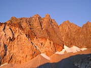
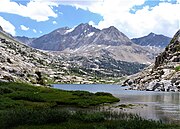
Mountain in the state of CaliforniaMount Tinemaha is a 12,520-foot-elevation (3,820-meter) mountain summit located east of the crest of the Sierra Nevada mountain range, in Inyo County of northern California. It is situated on the eastern boundary of the John Muir Wilderness, on land managed by Inyo National Forest. It is 1.3 mile southeast of Tinemaha Lake, and 1.8 mile northeast of parent Split Mountain. Topographic relief is significant as the east aspect rises 5,900 feet above Owens Valley in two miles.
Read article
Top Questions
AI generatedMore questions
Nearby Places

Split Mountain (California)
Mountain of the Sierra Nevada in California, United States

Birch Mountain
Mountain in Sierra Nevada range, California, United States

Taboose Fire
2019 wildfire in Eastern California

Cardinal Mountain
Mountain in the American state of California

The Thumb (California)
Mountain in the American state of California

Mount Bolton Brown
Mountain in the state of California

Mount Prater
Mountain in the state of California

Mather Pass
Mountain pass in the Sierra Nevada, California


